
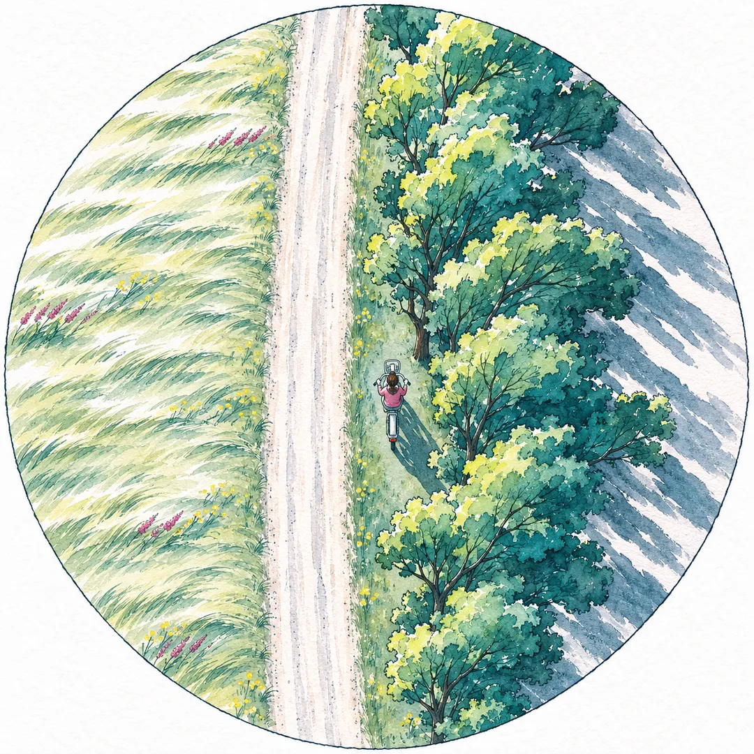
No agency publishes a wind limit for bicycles, so the useful number is the gust forecast, not the average wind. A workable rule for a lightweight pedal-assist e-bike: ride normally when gusts stay under about 25 mph, ride with care on sheltered routes up to about 40 mph, and leave the bike when gusts reach 40 mph or the National Weather Service issues a Wind Advisory. Do not start a ride under a High Wind Warning, which the Weather Service issues for sustained winds of 40 mph for an hour or more, or gusts of 58 mph.
That rule is ours, a planning rule of thumb, not a safety standard. The rest of this guide explains where the numbers come from, how to read the forecasts that NWS Cheyenne and the other Front Range offices publish, where gusts hit hardest on a route, how to ride a crosswind and a headwind, and how much battery a headwind costs. It is written for riders on the High Plains and the Colorado Front Range, where Colibrino plans its stations, and for the hosts who write weather rules for a shared program.
How windy is too windy to ride a bike?
Too windy is when gusts can move the bike sideways faster than you can correct. For a confident adult on a lightweight e-bike, that point comes somewhere around 40 mph gusts, and much lower for new riders, children, riders carrying bags or anyone riding next to traffic. Below 25 mph, wind mostly costs effort and battery; between 25 and 40 mph, it starts to steer the bike.
We could not find a wind limit for bicycles published by a standards body or a federal agency. The National Weather Service products described below are about wind and its effect on people, property and travel in general, not about bikes. So the rule in the table uses them as decision triggers, and it borrows a second check from the Beaufort Wind Scale, which describes what each wind strength looks like on land. If you cannot get a forecast, you can look out the window at the trees.
| Band | What the forecast says | What you see outside (Beaufort land cues) | What a rider does |
|---|---|---|---|
| Ride | Gusts under 25 mph | Dust, leaves and loose paper lifted; small trees in leaf begin to sway (force 4 to 5, about 13 to 24 mph) | Ride normally. Plan the route by wind direction. |
| Ride with care | Gusts 25 to 39 mph | Larger branches moving, whistling in wires; at the top of the band whole trees move and walking into the wind takes effort (force 6 to 7, about 25 to 38 mph) | Sheltered route, lower speed, both hands on the bars, short trips. New riders and children wait. |
| Wait | Gusts 40 to 57 mph, or any Wind Advisory | Twigs breaking off trees, wind impedes progress; at the top, slight structural damage (force 8 to 9, about 39 to 54 mph) | Do not start a ride. If already out, walk the bike through open stretches. |
| Stay off | High Wind Warning, or gusts 58 mph or more | Trees broken or uprooted, considerable structural damage (force 10 and up, about 55 mph and more) | No riding. A shared program may close its stations. |
Why these numbers
The 25 mph line sits where the Beaufort scale’s force 6, “strong breeze,” begins: 22 knots, or about 25 mph, when NOAA’s Storm Prediction Center lists “larger tree branches moving, whistling in wires.” The 40 mph line sits where force 8, “gale,” begins: 34 knots, about 39 mph, described on land as “twigs breaking off trees, generally impedes progress.” The upper lines are the Weather Service’s own triggers: a Wind Advisory for sustained 30 to 39 mph winds and a High Wind Warning for sustained 40 mph winds or 58 mph gusts.
Adjust the bands down, never up. Lower them if you are new to e-bikes, riding a route you do not know, carrying a bag on one side, towing anything, or riding where a sideways push would put you into traffic. A shared program’s rules may also set a lower line than this table, and those rules apply to its bikes.
Why gusts matter more than the average wind speed
A gust is a short burst of faster wind, and it is the burst, not the average, that pushes a bike off its line. The Weather Service’s glossary defines sustained wind as “wind speed determined by averaging observed values over a two-minute period,” and a wind gust as rapid fluctuations in wind speed “with a variation of 10 knots or more between peaks and lulls,” where the gust’s speed is the maximum instantaneous wind speed.
The Wyoming State Climate Office makes the same point about the records most people see. Hourly winds measured at airports are normally two- or three-minute averages of three- or five-second samples, and, in its words, “These are not gusts.” That is why a calm-looking yearly average can hide a dangerous day. At the Cheyenne airport in 2025, the National Weather Service’s annual climate summary recorded an average wind speed of 11.3 mph, a highest wind speed of 54 mph on December 9 and a highest gust of 75 mph on December 19.
The push grows with the square of the speed
The Climate Office gives a wind-load formula, P = 0.00256 × V² × Cd, where P is pressure in pounds per square foot, V is wind speed in mph and Cd is a shape coefficient. Its worked example is a 4 by 8 foot sheet of plywood facing the wind at sea level: 9.8 pounds of pressure at 10 mph, 61 pounds at 25 mph and 245 pounds at 50 mph. Double the wind speed and the push roughly quadruples.
A rider and a bike are not a sheet of plywood, but the square law still holds for the air pressing on them. A 40 mph gust arriving on top of a 20 mph wind does not push twice as hard as the steady wind. It pushes about four times as hard, and it arrives in seconds.
What a gust does to a bike
A steady crosswind is manageable because you lean into it and the bike settles. The trouble comes from change. A gust arrives and pushes the bike toward the downwind side of the lane; a moment later the lull arrives and, because you are still leaning into a wind that has dropped, the bike swings back toward the wind. Both moves happen faster than on a calm day, and both are larger on a lightweight bike with a tall, upright rider. Riding well in wind is mostly about leaving room for those two moves.
Reading National Weather Service wind products before a ride
The Weather Service issues three kinds of wind products that matter to a rider, and each has a written trigger. Its national specification, National Weather Service Instruction 10-515 (May 16, 2025), sets them out in its products table.
| Product | What it means (NWSI 10-515) | Our band |
|---|---|---|
| Wind Advisory | Sustained wind speeds of 30 to 39 mph lasting for 1 hour or longer, or locally defined | Wait |
| High Wind Watch | Conditions are favorable for a high wind event to meet or exceed High Wind Warning criteria in the next 12 to 48 hours | Plan for no riding |
| High Wind Warning | Wind speeds forecast to meet or exceed locally defined criteria; typical values are sustained 40 mph or more for 1 hour or longer, or winds of 58 mph or more for any duration | Stay off |
| Blowing Dust Advisory or Warning | Widespread blowing dust cutting visibility to 1 mile or less (advisory) or 1/4 mile or less (warning); winds of 25 mph or more are usually required | Wait |
Two details in the same instruction change how a rider should read these. First, offices should issue warnings and advisories when there is an 80 percent or greater chance of the event, and watches when there is a 50 percent or greater chance. A watch is therefore a real signal to plan around, not a maybe. Second, the instruction says criteria “are to be considered as guidance only, not strict thresholds,” and that forecasters may issue products at lower criteria when the timing or circumstances make an event dangerous. A warning on a day that looks borderline is a forecaster’s judgment worth taking seriously.
What NWS Cheyenne publishes
The Cheyenne forecast office has a High Wind page built for exactly this decision. It shows gust forecast maps for Day 1 through Day 5, two-day hourly forecasts for four wind-prone locations (Interstate 80 at Arlington and at Buford, Interstate 25 at Bordeaux and at Wyo Hill), a map of wind-prone locations across southeast Wyoming, and the latest High Wind Warning text. The office says this guidance is based on its own wind research, published in the American Meteorological Society’s journal Weather and Forecasting.
Front Range riders in Colorado have the same product types from the NWS Denver/Boulder office. Whatever office covers you, the habit is the same: look for any watch, warning or advisory for your county, then read the gust figure for the hours you will ride.
What a warning reads like
The wording tells you more than the headline. At 1:33 AM on December 19, 2025, NWS Cheyenne’s High Wind Warning for Central Laramie County, which includes Cheyenne, read: “West winds 40 to 50 mph with gusts up to 75 mph.” Under impacts it said: “Strong cross winds will be hazardous to light weight or high profile vehicles.” A bike and rider are both light and tall for their weight. That day the airport recorded its highest gust of 2025, 75 mph.
The end of a warning is not the end of the wind. When NWS Cheyenne cancelled a High Wind Warning for the Guernsey, Wheatland and Bordeaux area on the evening of November 20, 2026, the same message said that winds had dropped below warning thresholds but “wind gusts up to 50 mph will be possible over the next few hours.” By our bands, that is still a Wait day.
The forecast is for open ground
Forecast and observed winds describe a standard exposure. The Weather Service’s wind chill page notes that wind is measured at the national standard height of 33 feet, the typical height of an anemometer, and its glossary defines maximum sustained surface wind at an elevation of 10 meters with an unobstructed exposure. You ride lower, and often beside buildings and trees, so the wind on your route can be weaker in shelter and stronger in gaps. The next two chapters show where.
When the wind blows hardest on the High Plains
Wind on the High Plains follows patterns you can plan around: a season, a direction and a time of day. The Wyoming State Climate Office says Wyoming “ranks 1st in the US with an annual average wind speed of 12.9 mph” and that in winter there are frequent periods when the wind reaches 30 to 40 mph with gusts of 50 or 60 mph.
- Season. January is generally the windiest month at the Wyoming stations the Climate Office charts, including Cheyenne.
- Direction. Prevailing winds come from the west-southwest through west to northwest. Cheyenne’s strongest January winds come from the west and northwest, and in many places the trees lean east. Both of Cheyenne’s 2025 extremes in the climate summary came from the west: 280 and 270 degrees.
- Time of day. In the Climate Office’s charts of mean hourly wind speed by month, “the weakest winds occur in the mornings and the strongest winds occur in early to mid-afternoon.”
What an ordinary day looks like
The averages say a lot about everyday riding. Wyoming’s 12.9 mph state average and Cheyenne’s 11.3 mph average for 2025 sit at the edge of Beaufort force 4, “moderate breeze,” described on land as dust, leaves and loose paper lifted and small branches moving. In other words, an ordinary day here already has enough wind to notice on a bike, to choose a route by, and to cost some battery, without being a reason to stay home. The bands in this guide are for the days that are far from ordinary.
Windy days come in runs
December 2025 shows how warning days can cluster. NWS Cheyenne put Central Laramie County under a High Wind Watch and then a High Wind Warning from December 8 into December 11, with “west winds 35 to 45 mph with gusts up to 75 mph” in the forecast, and again on December 19. In a week like that, a rider who depends on a bike needs a second way to get around, and a shared program needs a way to tell riders when its stations close.
The same storm feels different across a city
The Climate Office lists practical rules for adjusting wind data to a place. Lower-roughness sites, such as open fields and wide parking lots, “will, in general, experience somewhat stronger winds,” while rougher sites with buildings and trees have weaker winds. That is why a ride across an open lot or along a prairie edge can feel far harder than the same ride three blocks into town.
Example (fictional). A rider on the west side of a High Plains city plans a 3-mile ride east to a campus at 8 a.m. and the ride home at 3 p.m. The forecast reads: west wind 15 to 20 mph in the morning, rising to 25 to 35 mph with gusts to 50 mph after noon, Wind Advisory from 1 p.m. The morning ride has a tailwind and gusts in the Ride with care band, so it goes ahead. The afternoon ride would be into a headwind in the Wait band. The rider either leaves campus before 1 p.m. or plans another way home and, on a shared bike, leaves it docked at the campus station.
Where gusts hit hardest on a route
Gusts are strongest where the wind is squeezed or where nothing blocks it, and calmest just downwind of something solid. Plan a windy-day route the way you would plan a route around construction.
- Gaps between buildings. The Weather Service’s glossary describes “channeled high winds”: in mountainous areas “or in cities with tall buildings, air may be channeled through constricted passages producing high winds.” On a smaller scale, a gap between two apartment buildings, a breezeway or a street that runs straight into the wind does the same.
- Building corners. Wind speeds up as it wraps around a corner. Riding out from behind a building is the classic moment for a sideways shove.
- Open ground. Parking lots, sports fields, prairie edges and wide intersections have nothing to slow the wind.
- Overpasses and bridges. They lift you above the surrounding shelter and usually have a barrier on one side and open air on the other.
- Passing vehicles. Trucks and buses pushing through a crosswind create their own gusts and their own wind shadow. Expect a push, then a lull, then a push.
Using shelter on purpose
The Climate Office gives a rule of thumb that explains why riders hug tree rows: “the effect of obstacles extends to a height of about twice the obstacle height and to a distance downwind of 10-20 times the obstacle height.” For example, a 25-foot row of trees or a two-story building disturbs the wind for roughly 250 to 500 feet on its downwind side. Inside that strip the wind is weaker and more broken; at its end, where the shelter stops, the full wind returns at once.
So use shelter, but expect the exit. Before the end of a building, a gap in a tree row, or an intersection that opens to the west, slow down, put both hands on the bars and look ahead to where you want the bike to go.
Which direction to fear
For the same wind speed, a crosswind is the harder one to ride, because it pushes the bike sideways and changes your steering. A headwind costs effort and battery but rarely moves the bike off its line. On a gusty west-wind day, a route that runs east and west on sheltered streets is usually easier to control than one that crosses open ground heading north or south, even if it is longer.
How to ride in a crosswind, a headwind and a tailwind
Riding in wind is about speed, space and a light grip. These habits apply to any bike; the e-bike notes are at the end of each list.
Crosswind
- Slow down before exposed stretches. Lower speed gives you more time to correct after a gust.
- Both hands on the bars. Wyoming law already requires a bicyclist to keep at least one hand on the handlebars at all times and not to carry anything that prevents the use of both hands (W.S. 31-5-705). In wind, use two.
- Relax your elbows and shoulders. Stiff arms pass every gust straight into the steering.
- Leave room on the downwind side. Wyoming law asks riders on a roadway to ride as near to the right side “as practicable” (W.S. 31-5-704). In a gust, practicable means keeping enough space that a sideways push of a foot or two does not put you into a curb, a parked car or a drop-off. When the wind blows toward traffic, choose a quieter street.
- Lean only as much as the wind asks. Expect the lull, and be ready for the bike to swing back.
- Ride single file. Wyoming allows two abreast in some conditions (W.S. 31-5-704), but in gusts each rider needs the whole width.
- E-bike note. Keep starts gentle. A strong assist surge from a standing start, just as a gust arrives, is harder to control than a smooth start in an easier gear.
Headwind
- Shift to an easier gear and keep your pedaling steady. Accept a slower speed.
- Lower your upper body a little. Less of you faces the wind.
- Raise the assist one level if you need it, and watch the battery gauge.
- E-bike note. A pedal-assist bike makes a headwind far less tiring, which is one of its real advantages here. It does not make gusts any weaker, so the bands still apply.
Tailwind
- Watch your speed. A Class 1 e-bike’s motor stops helping at 20 mph, as the class definition in Wyoming’s statute says (W.S. 31-1-101), but a strong tailwind can carry you faster without any help from the motor.
- Brake earlier. Wyoming’s equipment rule asks that a bicycle’s brake stop it within 25 feet from 10 mph on “dry, level, clean pavement” (W.S. 31-5-706). Faster speeds and dusty or gravel-covered pavement need far more room.
- Expect the wind to change at corners. A tailwind becomes a crosswind as soon as you turn.
Children, cargo and new riders
Some riders should use lower bands than the table. A lighter rider has less weight to resist a sideways push, so children and small adults feel the same gust more. A bag hung on one side of the bike, a backpack that catches air, or a child seat behind the saddle all add surface for the wind to push on. Someone in their first weeks on an e-bike is still learning how the bike responds to the assist and the brakes, and should not learn it in a crosswind.
For these riders, treat the Ride with care band as Wait. Every Colibrino program sets a minimum rider age with its host, and any program’s rules may set a lower wind line for everyone; both apply on top of this guide. A parent riding with a child on a separate bike should plan for the child’s limits, not their own.
When to get off and walk
If a gust moves you farther than you can correct by steering, or you find yourself fighting the bars for more than a few seconds, stop at a safe spot and walk the bike with both hands on the bars. Walking a few hundred feet across an exposed lot is not a failure of the ride. It is how the ride ends well.
Choosing an assist level for a headwind
Use the assist level to keep your effort and pedaling speed steady, not to hold a target speed. On a pedal-assist bike the motor adds to your pedaling; it stops when you stop pedaling or brake, as Wyoming’s e-bike section requires (W.S. 31-5-707). In a headwind that means you choose how much of the extra work the battery does.
- Calm or light wind: the level you normally use.
- Steady headwind: one level higher, in an easier gear. You arrive less tired and use more battery.
- Gusty crosswind: a moderate level and a smooth cadence. A very high level makes every pedal stroke a push, which is not what you want when a gust is already pushing.
- Long exposed climb into the wind: a higher level, with a check of the battery before you start.
Our article on pedal-assist levels explains what each level does and how levels differ from a throttle. Colibrino bikes are Class 1: the motor helps only while you pedal, stops helping at 20 mph, and there is no throttle. The rider guide covers the assist controls on a shared bike.
How much range a headwind costs
A headwind can cost a large share of a charge, because the air you push against depends on your speed plus the wind’s. The square law from the Climate Office’s formula applies here too. Riding at 12 mph in calm air, you meet 12 mph of moving air. Riding at 12 mph into a 15 mph headwind, you meet 27 mph of moving air, and (27 ÷ 12)² is about 5. So the air pushes back roughly five times as hard as on a calm day.
The same arithmetic for a rider holding 12 mph on the ground shows how fast the air’s share climbs:
| Wind | Air moving past the rider | Air push compared with calm |
|---|---|---|
| Calm | 12 mph | 1 times |
| 10 mph headwind | 22 mph | about 3.4 times |
| 15 mph headwind | 27 mph | about 5.1 times |
| 20 mph headwind | 32 mph | about 7.1 times |
| 25 mph headwind | 37 mph | about 9.5 times |
| 10 mph tailwind | 2 mph | almost none |
The table applies the square law to the air alone. It is a way to see why the gauge drops faster into the wind, not a measurement of any particular bike.
Total battery use does not rise five times, because tire rolling resistance, the bike’s weight and your own pedaling do not change with the wind. But it rises steeply, and a headwind both ways on a long trip can be the difference between docking with a margin and walking the last mile. Bosch, a maker of e-bike drive systems, treats wind as a range input: its range assistant asks for wind conditions alongside riding mode, terrain, stop frequency, total weight, surface, tire tread, cadence and season.
Estimating it before you leave
The range estimator handles wind with one input, “extra energy for headwind, hills or load.” Its default example, with 80 percent of the battery available in the cold and 25 percent extra energy, gives 15.4 miles, against 24.0 miles on a mild, calm, flat day. On a windy day, raise the extra-energy input and see what is left.
Example (fictional). A rider has a bike with a 400 Wh battery, plans to use 90 percent of it, and uses about 15 Wh per mile on a calm, flat day. The day is mild, so 100 percent of the battery is available. The commute is 4 miles each way. The morning ride is into a strong west wind, so the rider sets extra energy at 60 percent: 4 miles × 15 Wh × 1.6 = 96 Wh. The ride home has the wind behind, so extra energy is 0: 4 × 15 = 60 Wh. The round trip uses about 156 Wh of the 360 Wh available. Had the rider gone out with the tailwind and come home into it in the stronger afternoon wind, the second leg would have been the expensive one, at the end of the day. These input values are assumptions for illustration; your own bike’s energy use will differ.
Ride into the wind first
When you have a choice, start a round trip into the wind. You meet the headwind while you are fresh and the battery is full, and the tailwind carries you home when both are lower. On the High Plains the timing helps: the Climate Office’s charts show winds are usually weakest in the morning and strongest in early to mid-afternoon, so a morning ride out and an early return often avoids the windiest hours.
On a shared bike the stakes are lower, because the bike charges in its bay after every ride and you rarely see the bottom of the battery. Check the gauge before you leave (it is the first item on the pre-ride checklist), and on a long windy trip choose the bike with the fullest charge.
Dust, debris and cold on windy days
Strong wind brings other hazards with it. The Weather Service issues blowing dust advisories when widespread blowing dust cuts visibility to a mile or less, and notes that winds of 25 mph or more are usually required. At the Ride with care level, expect grit in your eyes and reduced visibility near unpaved lots, construction sites and dry fields.
- Eyes. Clear or tinted glasses keep grit out and let you keep your eyes on the road.
- Debris. Branches, trash cans on collection day, cones and loose signs end up in bike lanes. Scan farther ahead than usual.
- Hearing. Wind noise covers the sound of vehicles behind you. Use your mirror if you have one, and look before you move left.
- Cold. Wind makes cold air feel colder on your skin. The Weather Service’s wind chill chart gives a -19°F wind chill for an air temperature of 0°F and a 15 mph wind, a level at which exposed skin can freeze in 30 minutes. Riding adds its own breeze on your face. Our guide to riding an e-bike in winter covers dressing, ice and battery range in the cold.
Wind rules for shared e-bike programs
A shared program needs a written wind rule, so riders and staff are not deciding on the spot. The simplest rules tie decisions to products the Weather Service already issues, and say who tells riders what.
What a good wind rule contains
- The trigger. Name the products: for example, no new rides when a High Wind Warning covers the station’s county, and a rider notice when a Wind Advisory is issued.
- What riders should do. Do not start a ride in a warning. If you are out when the wind rises, walk the bike to the nearest station and lock it into a bay.
- What happens at the station. Whether it stays open, closes to new rides, or closes outright, and who decides.
- How riders hear about it. App notice, email, text, a sign at the station, or all of them.
- When it reopens. Usually after the warning ends and the station has been checked.
Colibrino puts this in writing for every site. Each network plan includes a written winter plan that covers what happens in a storm or a high-wind warning and how riders are told about closures; seasonal operations describes it. Stations are anchored, kept low-profile, and placed on the sheltered side of a building where the site allows, which the site walk notes.
Example (fictional). The rider rules for Larkspur Commons, the fictional 240-home apartment community used across this site, include a wind section: “When the National Weather Service issues a High Wind Warning for our county, please do not start a ride. Bikes already out should be walked back and locked into a bay. A notice goes to every member when a warning begins and when riding resumes. When a Wind Advisory is in effect, new riders and anyone carrying bags are asked to wait.”
Why bikes belong in their bays on windy days
A bike standing on its kickstand in a 50 mph gust is likely to fall over, and a fallen bike can damage itself, a car or a person. A shared bike locked in a bay is held upright and charging. That is one reason the rider guide asks riders never to leave a bike outside a bay. If every bay at a station is full, ride to the next station or call support rather than leaving the bike loose.
Local context
Wind shapes station design in this region. Our page on Cheyenne, Wyoming explains why Colibrino plans from there: anchoring, a low weather hood rather than a tall sign, and a spot in the lee of a building where possible all follow from the same wind records this article uses.
A windy-day checklist
Before you ride on a day with wind in the forecast, run through this list. It takes about two minutes.
- Check for products. Is there a Wind Advisory, High Wind Watch or High Wind Warning for your county? NWS Cheyenne’s High Wind page shows the latest for southeast Wyoming.
- Read the gust figure for the hours you will ride, not just the morning number.
- Place it in a band. Under 25 mph, ride. 25 to 39 mph, ride with care. 40 mph or an advisory, wait. A warning or 58 mph, stay off.
- Note the direction. Plan the windiest leg first, and prefer a headwind to a crosswind on exposed ground.
- Pick a sheltered route. Avoid open lots, gaps between buildings and overpasses where you can.
- Check the battery and, for a long trip, run your numbers in the range estimator with extra energy for the wind.
- Do the bike check. The pre-ride checklist covers brakes, tires and lights.
- Ride slower, with both hands, and leave room on the downwind side.
- Walk when a gust moves you more than you can correct.
- Dock in a bay at the end, and report anything the wind damaged.
For more on the season, read riding an e-bike in winter, or browse the other articles in Riding e-bikes. If you manage a property or campus and want a station planned around this region’s wind, start with a site walk through the contact page.